


For years we have talked about desertification as a future threat or a shadow that looms over the Iberian Peninsula. Now, thanks to data science and the joint work of the University of Alicante (UA) and the CSIC, we have stopped talking about probable futures to talk about tangible presents, and the truth makes us rethink many things.
The reality. In order to get an idea of what our country faces, researchers have prepared the First Atlas of Desertification of Spain (ADE). This is not just a map, but it is a complete X-ray of the health of the Spanish soil based on decades of data that we had accumulated and that has served to understand the trend of the country.
The diagnosis in this case is quite clear: more than 40% of the national territory suffers a degradation process. But although this is an alarming figure, it is not the most worrying. Atlas itself reveals our relationship with water: technology and intensive irrigation are ‘covering up’ a problem that is advancing silently under our feet and that we are not seeing.
An exhausted soil. To understand this research, we must first kill a myth: desertification does not mean that Spain is becoming the Sahara full of dunes, although it is a reality that aridity is increasing.
As the project coordinators, Jorge Olcina (UA) and Jaime Martínez Valderrama (CSIC), explain, desertification is the degradation of land in dry areas. It is a process by which the soil loses its biological and economic capacity to produce. Stop being fertile.
The data. There are two points to take into account in this case. The first of them is that 40.9% right now are showing signs of degradation. But if we go to the ‘dry lands’ such as arid, semi-arid and dry subhumid areas, the percentage of “sick” territory shoots up to 60.94%.
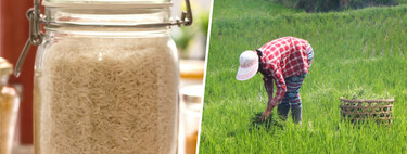
The paradox of irrigation. One of the most interesting points in this case is the role that agricultural technology is playing. And although right now it may be thought that the irrigation system can combat desertification, the study points out that in many cases it can accelerate it. That is, the opposite effect.
The report details how intensively irrigated agriculture acts as a “cover-up mechanism.” Thanks to fertilizers and the massive extraction of groundwater, we can see very green crops on the surface, which makes us think that there are no problems with them. But the reality is very different.
The demonstration. The Atlas has cross-referenced the data on the amount of chlorophyll and biomass that can be seen on earth with the state of water resources and the reality that emerges. For science, we are right now maintaining that greenery at the cost of depleting the aquifers and salinizing the soils, as can occur in the maintenance of very profitable crops such as avocados in the south of the peninsula.
A devastating fact from the report illustrates this: in the Guadiana basin, 86% of the aquifers show rates of overexploitation or degradation linked to this phenomenon. And we are giving a lot of weight to maintaining the color green while we are ‘charging’ our water resources.
The state by zones. The Atlas, which consists of more than 60 thematic maps generated using Big Data and Artificial Intelligence, allows you to zoom in on critical areas. The “zero ground” of desertification in Europe is clearly drawn in the southeast of the peninsula, where there are some highly affected regions:
- Region of Murcia: it is the most affected community, with extreme water pressure and increasing aridity.
- Valencian Community and Andalusia with large areas of intensive cultivation that overlap with areas of high climatic vulnerability.
- Canary Islands with an island location that adds an extra risk factor to land management.
- La Mancha and Aragón are inland areas that, although less in the media, are suffering accelerated degradation due to agricultural transformation.
Specific case. In addition to this information, the report points to strategic locations such as the Sierra de Gádor in Almería, which suffered from 19th century mining and therefore deforested holm oak and espart forests with 52,000 tons of charcoal from half a million destroyed trees, leaving skeletal soils that last for centuries despite repopulation.

Changing the rules. This is something really important, because until now Spain depended on more general or outdated maps. ADE changes this by introducing socioeconomic variables into the equation. Not only does it look at how much it rains (which is becoming less and more torrential), but also at how we use the water that falls.
The document warns that 42% of the national territory consumes more than 80% of the available fresh water. In a context of climate change, where rainfall will be more erratic and temperatures higher, maintaining this model is physically impossible.
Images | giovanni cordioli Being Organic in EU
In WorldOfSoftware | The drought is turning water into a very scarce and valuable commodity in Spain. And there are already organized groups of thieves


