


The heat, undisputed protagonist of the first half of the summer, seems to give us a truce. This time it is not a two or three day truce in which storms lower the temperature for a couple of days before the return of temperatures even more extreme than the previous ones.
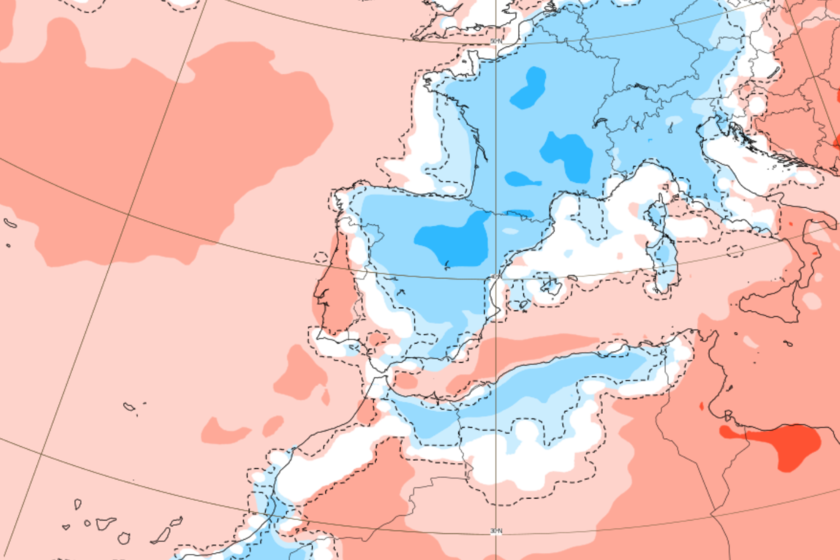
More fresh. Meteorological models foresee a week closer to normal as far as temperatures are concerned. Moreover, during the next few days we can see negative thermal anomalies in a good part of the Iberian Peninsula, that is, cooler temperatures than would correspond to these dates.
Looking at the polar jet. How have we gone from a record heat to this “normality”? The answer to this question seems to be, mainly, in the polar jet. More specifically, in the undulations that this current draws over its course.
The polar jet is a barrier that separates cold air masses from the warmer air pole from subrtical latitudes. When winding can make polar air masses reach lower latitudes, bringing instability to these areas, which is what is expected to occur this week.
We continue in summer. Of course, from the State Meteorology Agency (Aemet) they remember that we continue in summer, and near the cannula, so fresh temperatures do not imply that heat will be completely. Aemet’s forecasts talk about temperatures that could continue to exceed 34º in southern areas during much of the week.
In fact, it maintains several notices due to high temperatures for the next few days, in some areas of Andalusia, Murcia and Alicante. These notices will live on Wednesday with storms and rain warnings in some areas of the Pyrenees. Thermal relief will not imply a somewhat revolt situation.
A new trough. And it is that thermal relief will not imply a less revolt situation. A trough driven by the polar jet will bring storms that can be intense in areas of the north and west. It is expected that the worst of this episode will begin to be noticed on Wednesday north of the Mediterranean aspect, extending during the following days to Levante and Balearic Islands.
As described by the Geographer Samuel Biener in Meteored, “it is not an episode of generalized rains, but of stormy nuclei of a very irregular nature and capable of generating adverse phenomena, something that is common at this time.” On Friday the trough will lose its influence on our territory.
Back to heat? By the weekend the situation could change again, which seems to indicate the return of heat for next week. Although there is still uncertainty, some models indicate the return of heat at altitude, which would advance the arrival of new warm episodes such as those we saw the month of June. It may be more if we take into account its proximity to the days of cannula.
In WorldOfSoftware | The hydrological bonanza could not be eternal: drought is a real threat after an extremely warm, and also dry June
Imagen | ECMWF


