Google DeepMind introduced AlphaEarth Foundations, an artificial intelligence model designed to integrate massive volumes of Earth observation data into a unified digital representation of the planet. The system, described as functioning like a “virtual satellite”, can process petabytes of multimodal inputs.
The model addresses a long-standing challenge in Earth science: the difficulty of combining data from diverse sources and refresh rates into formats that researchers can use consistently. By compressing information into highly compact summaries, AlphaEarth Foundations reduces storage requirements by a factor of 16 compared to other AI systems tested by Google.
According to Google, AlphaEarth Foundations has been validated against both conventional techniques and other AI mapping approaches, achieving a 24 percent lower error rate on tasks such as identifying land use and estimating surface properties. The model was found to be especially effective in situations with limited labeled data, a common constraint in global environmental monitoring.
Some observers have welcomed the focus on targeted, real-world applications rather than broad general-purpose AI systems. As one Hacker News user commented:
Overall, this is what I love about DeepMind. They find practical applications for existing technologies, showing that we do not have to create a huge, universal AI model to solve a specific problem.
The system is already being tested by more than 50 organizations, which are applying it to tasks such as mapping unmapped ecosystems, tracking agricultural development, and detecting environmental change. One researcher in the field echoed this enthusiasm:
I am a GIS researcher. This is incredible. I can not wait to see it in action.
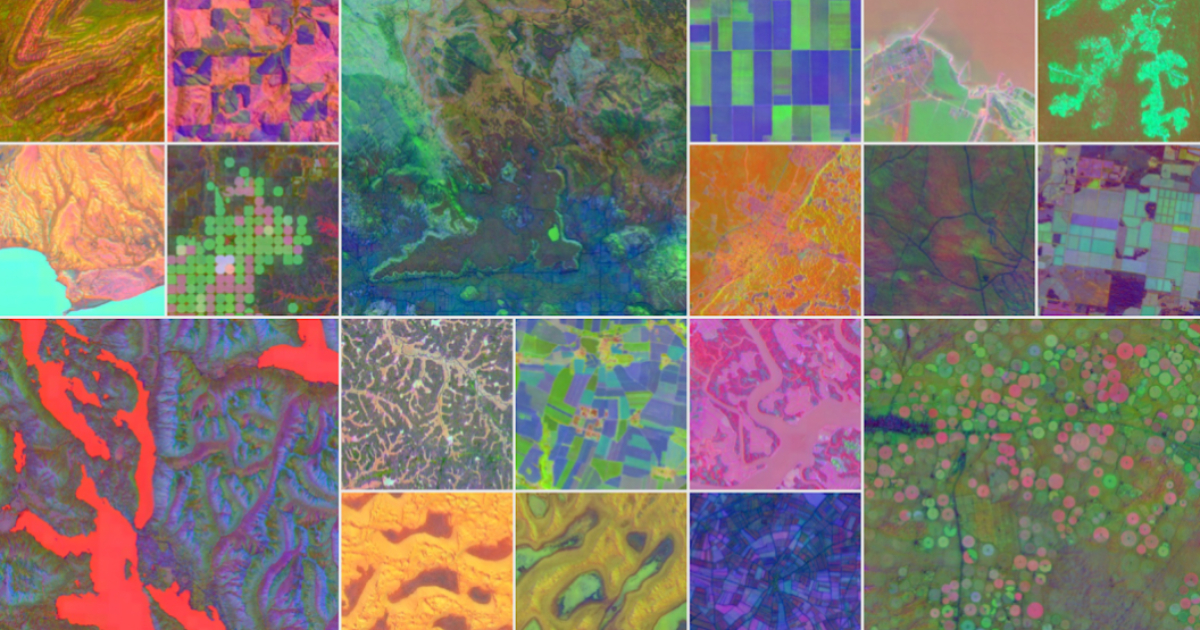
Visualizations provided by Google show how the model can generate detailed images even in areas where traditional satellite monitoring struggles. In Ecuador, for instance, AlphaEarth Foundations was able to reveal farmland obscured by persistent cloud cover.
The technical core of the system lies in its ability to fuse non-uniform data streams into a continuous spatiotemporal index. This allows scientists to generate on-demand maps that capture both the state of the land surface and its evolution over time.
Google positions AlphaEarth Foundations as part of Google Earth AI, its suite of geospatial tools aimed at supporting research on global environmental challenges. The company says future work will focus on integrating the model with general reasoning AI agents, such as Gemini, to further extend its analytical capabilities. More information can be found in the paper.


