Andy Walker / Android Authority
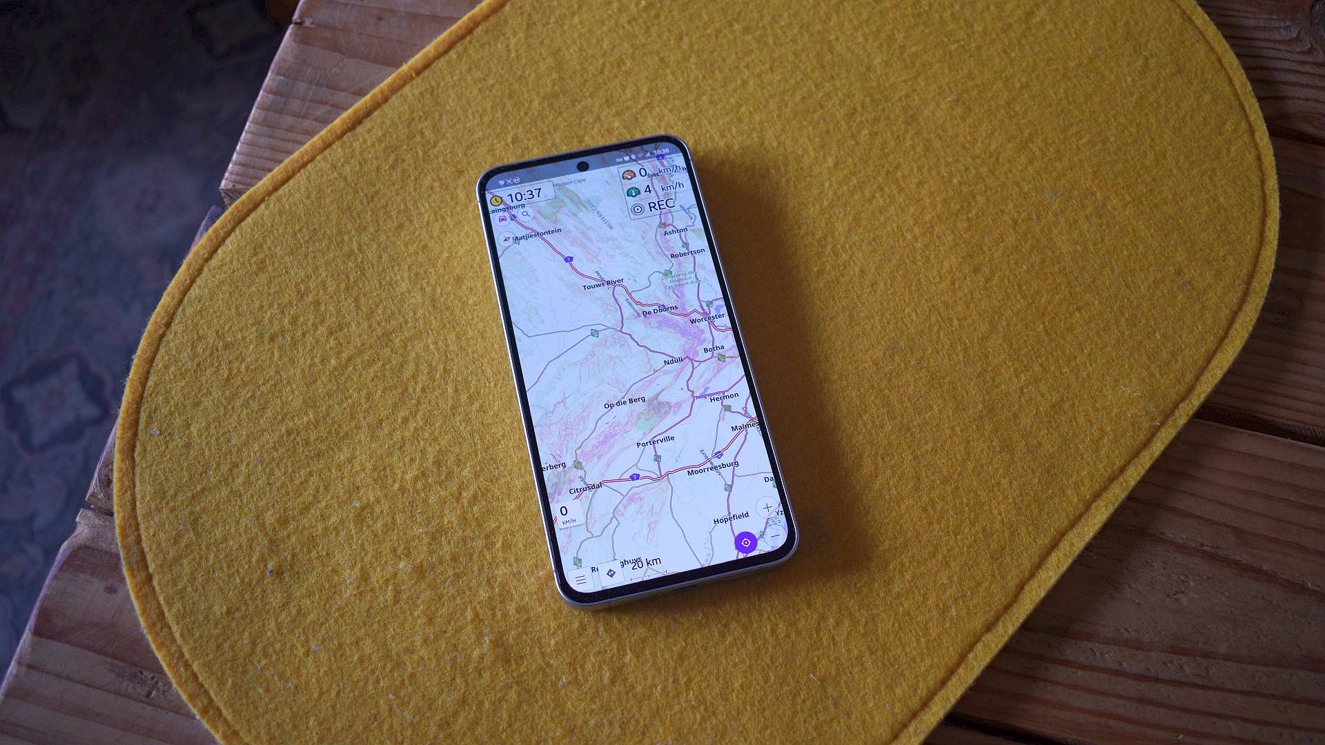
Google Maps was primarily designed for inner-city travel, where roads are well-marked and relatively smooth. I doubt the app’s developers envisioned users navigating gravel roads in the heartland of South Africa. So, it’s unsurprising that the app becomes far less useful once you hit the dirt. However, where Google Maps falls short, OsmAnd excels.
OsmAnd is a free, open-source app on the Play Store and F-Droid. It draws data from various sources, primarily relying on OpenStreetMap, which volunteers with local knowledge worldwide maintain. This gives it broader coverage of lesser-known routes that Google Maps often overlooks, providing OsmAnd a significant advantage when things get dusty.
What navigation app do you prefer when traveling on unpaved roads?
64 votes
Can country roads take me home?

Andy Walker / Android Authority
Although I rarely venture beyond paved roads in my higher-clearance, front-wheel-drive car, there have been times when I’ve needed to take an unpaved shortcut. In smaller towns, often the singular paved road in and out is blocked, forcing me to choose the alternative, dustier route. In these situations, I want to know the road surface and conditions throughout its length to know precisely what to expect. For the most part, I’d rather avoid situations where I might have to turn around, potentially running out of fuel or damaging my car.
Google Maps assumes every route is passable, and the UI doesn’t suggest otherwise.
Google Maps assumes that every route is passable, at least as far as its UI is concerned. It does a poor job of highlighting gravel routes, which is particularly problematic in my region. Several main thoroughfares are unpaved, while some are generally known as tire-killers. To avoid these, I need more information when faced with a dusty track.

Andy Walker / Android Authority
While Google Maps fails in this regard, OsmAnd shines. Using the Map Styles option, I can display road surface and smoothness data on my Android Auto screen, providing valuable insights into a route’s challenges. I might consider taking a longer, safer path if a shorter route consists of sand or mud. It also highlights whether the smooth asphalt road becomes a more treacherous unpaved track.
On OsmAnd, each surface type is color-coded, and road smoothness is indicated by line style. It’s easy to distinguish between tarred roads, passable gravel roads, impassable mud trails, or roads made of stone or grass. I use the Touring map style to display this information.
OsmAnd displays road surface and smoothness information on my Android Auto display.
Although plotting all this data or viewing the map from a low zoom distance can become convoluted, the benefits outweigh the drawbacks.
Other map styles, like Offroad, prioritize 4×4 trails if you spend most of your time on dirt. Overlays are also available, and my favorite is Slope, which shows an area’s incline or decline. The deeper the red, the steeper the climb. I can gauge how steep a road is when using it in conjunction with the Touring map style.
No signal? No problem

Andy Walker / Android Authority
Dovetailing with OsmAnd’s various map styles and extensive data sets is its offline map support. When traveling these routes, cell coverage isn’t guaranteed. While you can download offline maps for Google Maps, the data is limited. I find it silly that Google restricts content downloading to the visible area on the screen rather than the entire region. OsmAnd handles offline data much better, making it a superior choice when service is an issue.
OsmAnd supports offline map downloads for entire regions (and even the sea if you’re so inclined).
You can download maps for whichever region or country you desire, as well as data beyond the road. Fancy a boat ride during your adventure? OsmAnd offers nautical map downloads, too.
OsmAnd can import and display data from KML or GPX files if you’re traveling with friends who have recorded a route. This is useful for hiking and driving non-standard routes. Google Maps app doesn’t directly support GPX imports from its interface.
OsmAnd is brilliant except where it isn’t

Andy Walker / Android Authority
As you can probably tell, I’m a fan of OsmAnd. It’s one of the few apps I don’t mind paying an annual subscription for, least of all to unlock its Android Auto support. However, the app isn’t without its issues. As much as I prefer it to Google Maps off the highway, OsmAnd is one of the most frustrating apps I’ve ever used.
Let’s start with its customization options. While it offers extensive map styles, overlays, and detailed data, users must modify XML files to make even the smallest adjustments beyond the stock map styles. For example, if I want the Touring map style to only display surface smoothness for non-asphalt routes, I’d have to retrieve its XML file, find the line I want to edit, and save it in OsmAnd’s data folder, which is hidden within Android/data. If I don’t like the change, I’m forced to repeat the process. This could be fixed with a GUI map style editor allowing users to view changes in real-time.
As much as I like OsmAnd, some of its shortcomings drive me up the wall.
It’s also worth mentioning the baseline data OsmAnd employs. While OpenStreetMap offers clear advantages, it lacks some of Google Maps’ best features. Although OsmAnd displays points of interest, it’s almost useless for viewing detailed information. For example, Google Maps may show a camping spot’s gate times, reviews, and images, while OsmAnd may only indicate its presence.

Rita El Khoury / Android Authority
Then there’s OsmAnd’s search capabilities, which pale compared to Google’s. Maps usually knows where I want to go, even if it sometimes leads me astray. OsmAnd just doesn’t offer the same precision via its search bar.
Perhaps more frustrating is the app’s performance on Android Auto. OsmAnd is highly customizable, but the app grows slower the more data you overlay. Even my relatively modern Galaxy S24 FE struggles to relay mapping data to my car’s screen, while some map views are sluggish on the phone itself.
OsmAnd is full of compromises. Its list of cons is extensive, and many aspects are more challenging to use than they should be. But I wouldn’t want to be without it on a road trip, especially if I might take a surprise turn through the mountains. There is room for improvement, and I do not doubt that the developers will address most of these and other users’ concerns in future versions. Nevertheless, if you’re planning an adventure soon, consider adding OsmAnd to your device too.
Thank you for being part of our community. Read our Comment Policy before posting.


